
Wednesday, May 21, 2008
Participatory Ethics - Special Thematic Issue of ACME
Vol 6 (3) of ACME (an International E-Journal for Critical Geographies) is dedicated to Participatory ethics. The 10 papers making up the issue are of interest to PGIS/PPGIS practitioners and researchers.
Sunday, May 18, 2008
Launch of the Participatory Mapping Training Kit announced
Participatory mapping and development practitioners, activists and researchers identified the lack of training materials as a major constraint in the spread of good participatory mapping / PGIS practice. An initiative launched by CTA and other development partners will lead to the production of a modular, multimedia and multilingual training kit for trainers. The kit will ensure that participatory mapping and communication practices evolve and spread in an ethically conscious manner, ensuring that indigenous and other marginalised communities are effective in documenting, representing, and communicating their spatial knowledge, while taking a high degree of control over the process. It is understood that good practice would add value and authority to local knowledge, facilitate inter-generational knowledge exchange, contribute to building and supporting a cohesive community identity, and support sustainable planning through collaborative decision-making.
Saturday, May 17, 2008
Participatory 3D Modelling among Ogiek Indigenous Peoples in Kenya
In their article "Through the Eyes of Hunter-gatherers: Participatory 3D Modelling among Ogiek Indigenous Peoples in Kenya" publlished on Information Development and now freely available for download, Giacomo Rambaldi and his colleagues describe a participatory process by which Ogiek Indigenous Peoples in the Mau Forest Complex in Kenya rendered their spatial memories through the making of a georeferenced three dimensional model covering part of their ancestral territory. The paper focuses on the course of action and related human dynamics which led to the production of the map legend via deep reflections and intense negotiations among elders of different clans. The 3D mapmaking process proved to be a catalyst in stimulating memory, articulating tacit knowledge and creating visible and tangible representations of the physical, biological and cultural landscapes of the area in the 1920s. Elaborating and negotiating agreement on the elements of the map legend allowed the participants to gain greater clarity on meanings and relationships between natural and cultural features. Once completed, the model selectively displayed both the tangible and the intangible heritage of the Ogiek people. The composition of the legend and the making of the model stimulated collegial learning and community cohesion. The process has been perceived as a milestone for Ogiek clans in terms of working together towards a common goal, and in realizing the value and potential authority of their spatial knowledge once it was collated, georeferenced, documented and visualized.
Monday, May 12, 2008
Google Maps and San Diego wildfires
When wildfires broke out in San Diego, broadcast station KPBS used the My Maps feature in Google Maps to easily create and share a map that provided real-time updates on the location of the fires and the status of evacuation shelters. The map received millions of views in just a few days.
Giving Voice to the Unspoken: Video on Participatory 3D Modelling (P3DM)
"Giving Voice to the Unspoken" is a 20-minute video production showing the hands-on aspects of Participatory 3D Modelling (P3DM). P3DM is a PGIS/PPGIS method. The video supports all practical aspects of P3DM described in the resource book "Participatory 3-Dimensional Modelling: Guiding Principles and Applications" and documents in detail an exercise conducted within the Pu Mat National Park, a protected area in Vietnam.
Tuesday, April 22, 2008
Small Grants Program - Anthropology & Environment
The goal of the Anthropology & Environment Section's Small Grants Program is to foster collaboration among practicing and academic anthropologists, grassroots activists, and/or organizations and inspire innovative solutions to environmental issues.
For more information have a look at Funding opportunities for NGOs and researchers
For more information have a look at Funding opportunities for NGOs and researchers
Friday, April 18, 2008
2008 Call for grant applications from indigenous peoples’ organizations and their communities
The Indigenous Peoples Assistance Facility invites applications from indigenous peoples’ organizations and communities, as well as organizations that work with them, for grants to fund projects, innovative approaches and partnerships that promote the development of indigenous peoples and help them fulfil their aspirations.
Grants range from US$10,000 to US$30,000. Applicants must meet specific requirements and their proposals should respond to the needs of indigenous peoples in any of IFAD’s Member States.
E-mail and mail your applications to IFAD. The closing date for applications is 30 June 2008. IFAD will not accept applications after that date.
A panel made up primarily of indigenous members will work closely with IFAD staff to review proposals and make final recommendations on grant awards. The panel will review grant proposals on the basis of project relevance, feasibility and institutional capacity and make final recommendations on awards.
Activities likely to be considered for funding will build on indigenous culture, identity, knowledge, natural resources, intellectual property and human rights. Projects should improve indigenous peoples’ access to decision-making processes, empower indigenous peoples to find solutions to the challenges they face and promote collaboration in the public and private sectors.
Over the years IFAD has learned that entrusting direct management of resources and funds to indigenous communities and their institutions is an effective way to build capacity, self-determined development and ownership of programmes and projects.
To apply for a grant, read the call for proposal, the guideline for completing the application form and complete the application form.
Tuesday, April 15, 2008
A Primer of GIS: Fundamental Geographic and Cartographic Concepts By Francis Harvey
This pragmatic book introduces key concepts and skills to prepare students to understand and use geographic information systems (GIS). The text thoroughly explains what geographic information is, how it is represented and analyzed, and what it communicates about human and environmental activities and events that take place on our planet. Basic principles of map making and map reading are integrated with discussions of relevant information technologies and applications. Written in an accessible style, the text is organized into four parts that can be used in any sequence in entry-level and more specialized GIS courses. User-friendly features include practical examples and exercises, engaging vignettes, and helpful Internet resources.
Aboriginal Communities in Google Earth
Aboriginal Communities in Google Earth is a virtual globe program that is made freely available from the Google Corporation. The program maps the earth by superimposing images obtained from satellite imagery, aerial photography and GIS over a 3D globe. In an effort to better acquaint people with the Aboriginal communities of Canada, Google Earth has created a placemark file that, when used in conjunction with the Google Earth, allows users to virtually visit these communities.
Monday, April 14, 2008
Through the Eyes of Hunter-Gatherers: Participatory 3D Modelling among Ogiek Indigenous Peoples in Kenya
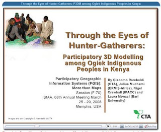
This PowerPoint, presented by Giacomo Rambaldi of CTA at the SfAA 2008 in Memphis, USA on 28 March 2008 describes a participatory process by which Ogiek indigenous people in the Mau Forest Complex in Kenya rendered their spatial memories through the making of a georeferenced three dimensional model covering part of their ancestral territory. Once completed, the model selectively displayed both the tangible and the intangible heritage of the Ogiek people. The composition of the legend and the making of the model stimulated collegial learning and community cohesion. The process has been perceived as a milestone for Ogiek clans in terms of working together towards a common goal, and in realizing the value and potential authority of their spatial knowledge once it was collated, georeferenced, documented and visualized.
Sunday, April 13, 2008
Mapping is Power
Set in the Altai Republic of Russia in southern Siberia, Mapping is Power follows cultural specialist Maya Erlenbaeva and shaman Maria Amanchina as they visit sacred sites near Kosh Agach. Indigenous people are mapping their sacred sites to protect them. This scene is a preview of Losing Sacred Ground, a 12-part series produced by the Sacred Land Film Project, which will profile sacred land struggles around the world.
Earth Island Institute’s Sacred Land Film Project
The Earth Island Institute’s Sacred Land Film Project produces a variety of media and educational materials — films, videos, DVDs, articles, photographs, school curricula materials and Web site content — to deepen public understanding of sacred places, indigenous cultures and environmental justice. Their mission is to use journalism, organizing and activism to rekindle reverence for land, increase respect for cultural diversity, stimulate dialogue about connections between nature and culture, and protect sacred lands and diverse spiritual practices.
Monday, April 07, 2008
Journey of our Life
A 14-minute participatory video production by PAFID - Mindanao documenting a journey to the land of the ancestors of Higaonon Indigenous Peoples living in Portulin, Bukidnon, Philippines. The virtual journey recreates experiences lived up by the members of the community in using a physical participatory 3D model (P3DM) to document, share across generations and safeguard their intangible cultural heritage.
Geo-visualisation for participatory spatial planning in Europe
 The principle of public participation in policy-making and policy implementation features in many European Union directives and policy documents. It is also undeniably connected to the rise of what can be called the European e-society, in which digital technologies are expected to strengthen public involvement in democratic processes. One broad group of such technologies are commonly referred to as geo-visualisations.This book contains the results of a European project that explored the potential for using innovative geo-visualisation techniques in public participation processes for spatial planning. The approach taken in the project involved continual interaction between concept development, the technological possibilities, and their practical application in case studies conducted in Belgium, Poland, Portugal, Spain and the Netherlands. The structure of the book mirrors this procedure. Three chapters discuss the general concepts of spatial planning and participation, e-interaction, and innovation in organisations. Two chapters present the results of research into the communicative potential and the usability of 3-dimensional geo-visualisations. The translation of these concepts and findings into practice is reported in five chapters devoted to the case studies.The project generated greater understanding of the ways in which geo-visualisation can help to improve public participation in the process of finding solutions to spatial planning issues. This book and accompanying DVD with extra information, is therefore a valuable resource for professionals and practitioners already working with geo-visualisations in participatory spatial planning as well as those looking to do so. They can turn to this book for insights and inspiration.
Friday, April 04, 2008
2008 Indigenous Planning Conference "Leading Change: Blending Indigenous and Western Planning Tools" (1-3 October 2008, Anchorage, Alaska, USA)
The Leading Change conference (1-3 October 2008, Anchorage, Alaska, USA) is sponsored by the American Planning Association’s (APA) Alaska and Hawaii Chapters and the Indigenous Planning Division. The three-day conference will bring together planners, tribal leaders, and community members to share local experiences, planning tools and practices that reflect a commitment to honoring history, cultural identity, tradition, and land tenure. Conference participants will share stories from their own communities organized around general topic areas including land use and natural environment; governance, nation building and leadership; local control, community sustainability, and resilience; culture, education, and community services; economy; and infrastructure, public services, and facilities.
Putting People on the Map: Protecting Confidentiality with Linked Social-Spatial Data
Precise, accurate spatial information linked to social and behavioral data is revolutionizing social science by opening new questions for investigation and improving understanding of human behavior in its environmental context. 
At the same time, precise spatial data make it more likely that individuals can be identified, breaching the promise of confidentiality made when the data were collected.
Because norms of science and government agencies favor open access to all scientific data, the tension between the benefits of open access and the risks associated with potential breach of confidentiality pose significant challenges to researchers, research sponsors, scientific institutions, and data archivists. Putting People on the Map finds that several technical approaches for making data available while limiting risk have potential, but none is adequate on its own or in combination. This book offers recommendations for education, training, research, and practice to researchers, professional societies, federal agencies, institutional review boards, and data stewards.
Intangible Cultural Heritage in Fiji - video clip featured at the WSA 2007 award winners ceremony
The World Summit Award (WSA) Awarding Ceremony has been the highlight of the entire WSA process 2005-2007 and a unique ceremony to honour excellence in multimedia and e-Content creation. Up to 40 winning Teams from all over the world were present at the event and were handed out the awards by highest level international dignities.
Sunday, March 16, 2008
Difference between Google Maps and Google Earth
The first question many nonprofits ask is: should we use Google Earth or Google Maps? The answer is both. Google "Earth" and "Maps" can be used in parallel to mazimise outreach (via your web site) and usefulness for the user as there are many tools that allow you to enter data once, and then create both custom Google Maps and Google Earth content overlays (KML files).To know more click this link.
Google Earth Outreach
Hundreds of millions of people now use Google Earth and Google Maps to explore the world around them. Google Earth Outreach gives non-profits and public benefit organizations the knowledge and resources needed to perform participatory mapping activites online. Click here to see how other organizations have benefited from Google Earth Outreach, then learn how to create maps and virtual visits to your projects.
Sunday, February 24, 2008
An Atlas of Radical Cartography
 An Atlas of Radical Cartography published by The Journal of Aesthetics and Protest, makes an important contribution to a growing cultural movement that traverses the boundaries between art, cartography, geography and activism. It pairs writers with artists, architects, designers and collectives to address the role of the map as political agent (rather than neutral document). Ten mapping projects dealing with social and political issues such as migration, incarceration, globalization, housing rights, garbage and energy issues, are complemented by 10 critical essays and dialogues responding to each map. The maps themselves are printed as posters, unbound for leisurely perusal. Among the contributors are artists Trevor Paglen, John Emerson, Ashley Hunt and Pedro Lasch, and essayists Avery Gordon, Heather Rogers, Alejandro De Acosta and Jenny Price.
Subscribe to:
Posts (Atom)